Mapping
Explore the historic character of South Yorkshire using our interactive map.
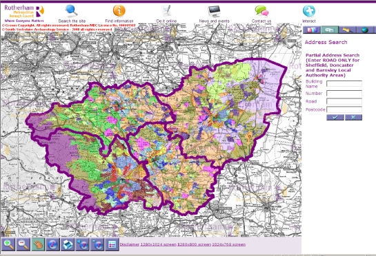
Figure 1: Interactive map of the historic character of South Yorkshire
Help Using the Mapping
For the mapping to work properly you should allow pop-ups from *.rotherham.gov.uk
This can be done in the settings of your internet browser.
- Navigate around the map using the tools in the left hand bottom corner or using the Address Search.
![]()
- See what each of the colours means using the Cartographic Legend.
![]()
- Select an area on the map with the Info Tool to find out about its historic character. This will bring up an Information Viewer with links to individual ‘Place Descriptions’ and broader ‘Zone Descriptions’, which will open in new windows.
![]()
To find out more about the Historic Environment Characterisation Project and how the information was gathered, see About the Project.